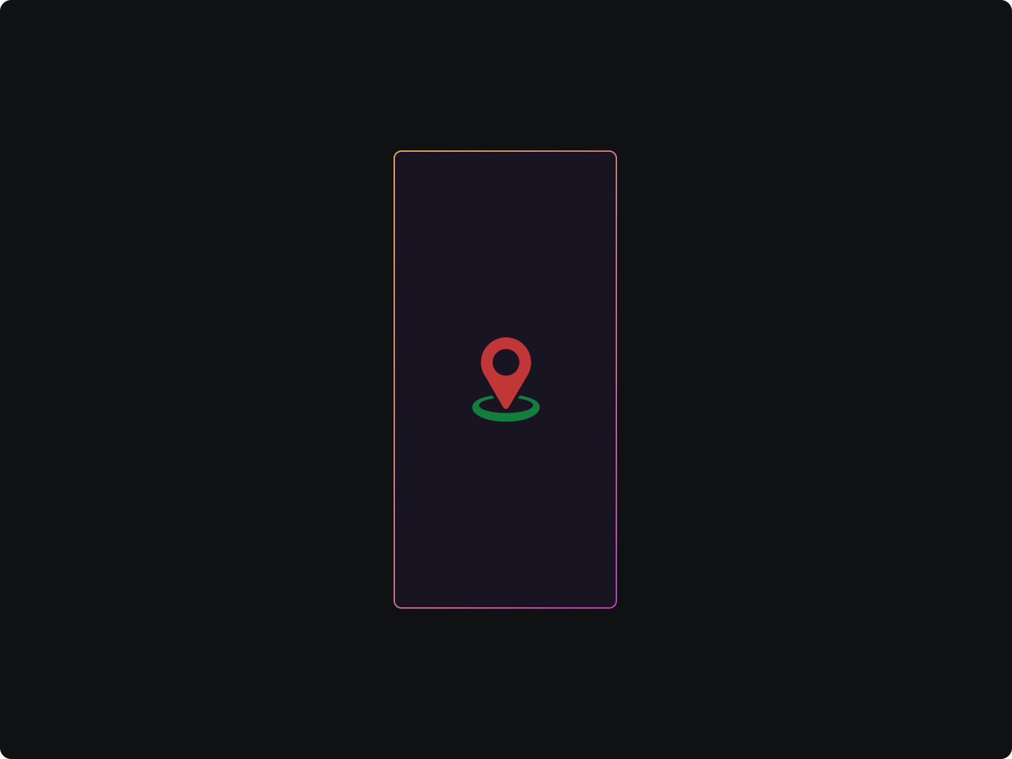
In today's connected world, the usage of location-based services has become ubiquitous, and it's not hard to see why. These services offer unprecedented levels of personalization and convenience, allowing apps to adapt their functionality based on where the user is.
What is Geolocation
- Consider a popular food delivery app. The moment it's launched, it identifies the user's location and suggests nearby restaurants. Or take into account a travel app that alters its recommendations based on whether users are planning a trip at home or are wandering around a new city.
- Such smart adaptations wouldn't be feasible without the power of geolocation, enabling apps to precisely pinpoint user locations. But knowing the coordinates is only the first part of the equation.
What is Reverse Geocoding
- Having acquired the user's location data, the next challenge lies in making sense of it. This is where reverse geocoding enters the scene.
- It transforms the raw geographic coordinates into meaningful location data, like the name of a city or an exact street address.
By harnessing the power of geolocation and reverse geocoding, developers can engineer immersive, context-aware experiences that users appreciate. In the following sections, a comprehensive guide is provided on achieving this feat.
Understanding Geolocation
In the world of mobile applications, geolocation is the ability to identify the geographical location of a device. This technology empowers apps to determine the precise location of a device, and thus, the user.
- One of the fundamental technologies enabling geolocation is the Global Positioning System, or GPS. However, it's not the sole player; Wi-Fi and mobile networks also contribute to location tracking.
- The choice between these technologies relies on several factors, including the required accuracy and the device's capabilities.
Geolocation in Android
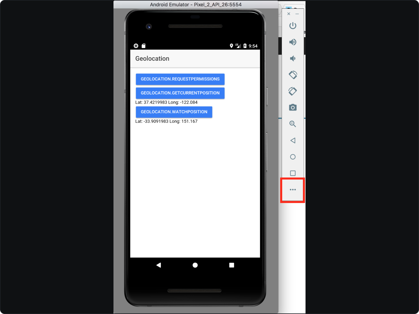
- In Android, geolocation capabilities are offered by the Location API, part of Google Play services. This API provides a high-level interface for acquiring user's location data.
- The Fused Location Provider is especially significant as it abstracts the underlying location technologies, presenting a simple yet flexible interface for developers.
As powerful as geolocation is, it brings with it substantial responsibilities. Among these, ensuring the user's privacy stands paramount. This often entails requesting the necessary permissions and maintaining transparency about how the location data is used.
Implementing Geolocation
Exploring geolocation services in a more experimental manner will help uncover possibilities that could significantly enhance the functionality and user experience of your app.
Location Update Intervals
- Create a LocationRequest object: This object will help specify the requirements for location updates.
- Specify Update Intervals: Set the intervals for receiving location updates.
- Set Priority: Set the desired level of accuracy.
Example
LocationRequest locationRequest = LocationRequest.create();
locationRequest.setInterval(10000); // set the desired interval for active location updates, in milliseconds
locationRequest.setFastestInterval(5000); // set the fastest interval for location updates, in milliseconds
locationRequest.setPriority(LocationRequest.PRIORITY_HIGH_ACCURACY); // set the priority of the request
Utilizing Different Location Sources
Though the Fused Location Provider automatically chooses the most suitable location source, understanding the different sources (GPS, Wi-Fi, cellular) can provide deeper insight:
- GPS: Offers the most precise location, but uses more battery power and requires a clear view of the sky.
- Wi-Fi: Useful in urban areas with a lot of network coverage.
- Cellular: Less precise, but useful when other sources aren't available.
Geofencing API
Beyond basic location tracking, Android also offers the Geofencing API which allows your app to take action when the device enters or leaves a certain geographical area.
An example of setting up a geofence with the Geofencing API:
GeofencingRequest geofencingRequest = new GeofencingRequest.Builder()
        .addGeofence(new Geofence.Builder()
                .setRequestId("myGeofence")
                .setCircularRegion(37.422, -122.084, 1000) // set the geofence's center and radius
                .setExpirationDuration(Geofence.NEVER_EXPIRE) // set how long the geofence should be active
                .setTransitionTypes(Geofence.GEOFENCE_TRANSITION_ENTER | Geofence.GEOFENCE_TRANSITION_EXIT) // set the transition types
                .build())
        .build();
Directions API for Route Planning
Google's Directions API can provide turn-by-turn navigation:
- Get API Key: Register your project on the Google Cloud Console to obtain an API key.
- Create a request: Generate a request URL containing origin, destination, and your API key.
- Process the response: The Directions API will return a JSON object containing the route information which can be parsed and displayed in your app.
By following these steps, developers can experiment with different aspects of Android's location services and create an app that uses location data innovatively and responsibly.
Understanding Reverse Geocoding
- Reverse geocoding is the process of converting geographic coordinates into human-readable addresses or place names.
- At its core, reverse geocoding involves taking a pair of geographic coordinates — latitude and longitude — and translating them into a format that is far more understandable for users.
- For instance, a set of coordinates could be translated to "123 Main Street, Anytown, Anywhere.”
While geolocation gives us raw coordinates, reverse geocoding tells us "where" in a way that users can comprehend and relate to. To understand this concept in more depth, readers can refer to the official Google documentation.
Implementing Reverse Geocoding
Using Android's Geocoder Class
- Android has a built-in class for reverse geocoding: the Geocoder class. It's a powerful yet straightforward tool to turn coordinates into a readable address.
Here's a simple code snippet that shows how to use the Geocoder class:
Geocoder geocoder = new Geocoder(context, Locale.getDefault());
try {
    List<Address> addresses = geocoder.getFromLocation(latitude, longitude, 1);
    Address address = addresses.get(0);
    String addressText = address.getAddressLine(0);
} catch (IOException e) {
    e.printStackTrace();
}
- In this example,
latitudeandlongituderepresent the coordinates for which you want to get an address. ThegetFromLocationmethod returns a list of Address objects that match the provided coordinates. - The third parameter specifies the maximum number of results to return. We use
1here because we're interested in the most relevant result.
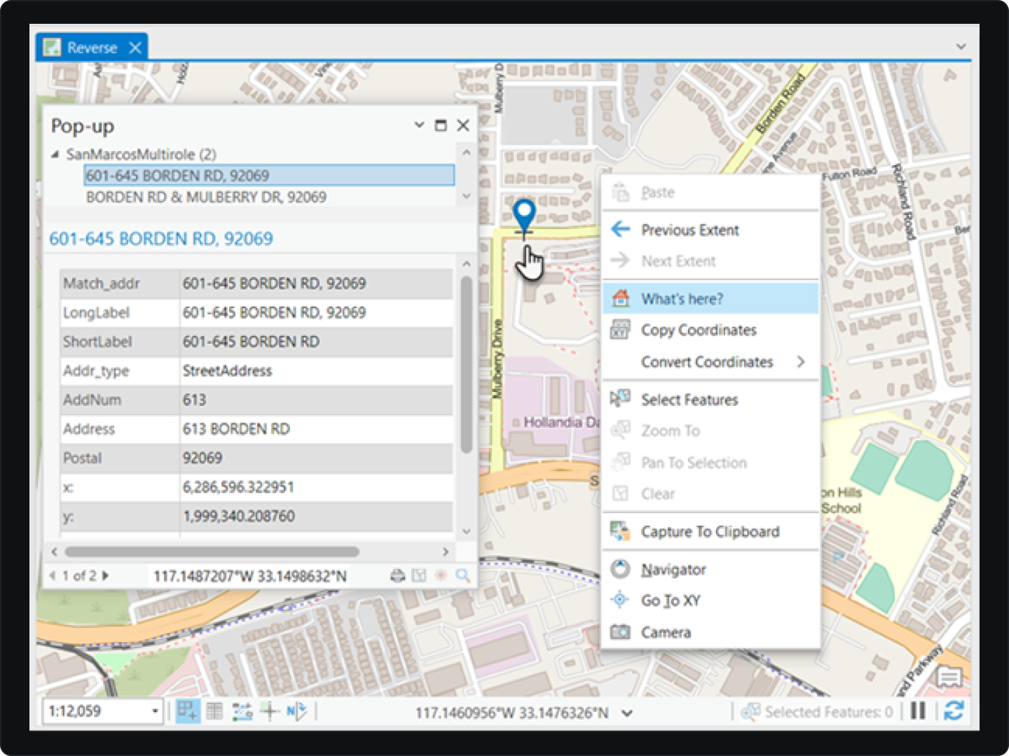
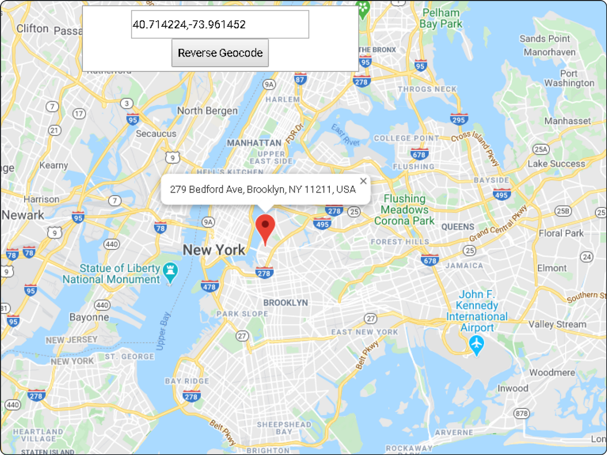
Reverse Geocoding with Google Maps API
- When combined with the Google Maps API, reverse geocoding can deliver a much more interactive and informative user experience.
- You might use the Maps API to show a marker at the user's current location. Then, you could use reverse geocoding to display an address for that location.
- This combination can be a bit more complex to set up, but it provides a seamless experience that feels both powerful and intuitive to users.
Reverse Geocoding Challenges
- Dealing with Lack of Internet Connectivity
- While the Android Geocoder class is a useful tool, it does require an active internet connection to work. This means that if a user's device is offline, you won't be able to perform reverse geocoding using this class.
- One solution could be to create a cache of known locations when the user is online, which can then be used when the device is offline.
- Handling Geocoder Service Not Available Issue
- Occasionally, you might encounter an "Service not Available" exception when using Android's Geocoder class.
- This happens when the Geocoder service is not available. A simple workaround for this issue is to use the Google Maps Geocoding API.
Here's an example on how to make a request to the Google Maps Geocoding API:
String apiKey = "YOUR_API_KEY";
String latlng = latitude + "," + longitude;
String url = "https://maps.googleapis.com/maps/api/geocode/json?latlng=" + latlng + "&key=" + apiKey;

// Make a request to the API
// Parse the response to extract the address
- Managing API Usage Limits and Costs
- When using Google Maps Geocoding API, be aware of the usage limits and potential costs associated with heavy use of the service.
- It's crucial to manage your app's usage to avoid unexpected charges. This can be done through efficient programming, such as batching requests and caching results.
By tackling these challenges head-on, developers can improve their skills, enhance their apps' user experience, and build a reputation for reliability and professionalism.
Responsible Use
Respecting User Privacy
- One of the pillars of responsible app development is respecting user privacy. When dealing with sensitive information such as location data, it is of paramount importance to handle it with the utmost respect and responsibility.
- Developers should clearly communicate to users how their data will be used, stored, and protected.
Requesting Permissions Wisely
- In Android development, it's essential to request permissions only when they're needed. This builds trust and reassures users that their data is only accessed when necessary.
- When requesting location permissions, explain why it's needed and how it improves their app experience.
if (ContextCompat.checkSelfPermission(thisActivity, Manifest.permission.ACCESS_FINE_LOCATION)
        != PackageManager.PERMISSION_GRANTED) {
    ActivityCompat.requestPermissions(thisActivity,
            new String[]{Manifest.permission.ACCESS_FINE_LOCATION},
            MY_PERMISSIONS_REQUEST_ACCESS_FINE_LOCATION);
}
In this code snippet, permission is being requested to access the user's precise location. Before making this request, it's advisable to provide a UI explanation.
Data Minimization and Retention
- Another part of responsible data handling is data minimization. Only collect the minimum amount of data necessary for your app to function.
- Similarly, retain that data only for as long as it's needed. For a detailed understanding of these principles, developers can refer to the Data Minimization section in the Android Privacy guide.
Secure Data Storage and Transmission
- Lastly, when you have to store or transmit location data, make sure it's done securely. Data encryption is key in preventing unauthorized access to this sensitive information.
FAQs on Geolocation and Reverse Geocoding
Why do I receive inaccurate location data in my Android application?
- Inadequate or improper permissions may result in inaccurate location data. Make sure you've requested and been granted the necessary permissions.
- Opt for the
ACCESS_FINE_LOCATIONpermission for high-accuracy location data, especially when the device's GPS is in use.
How can I reduce battery drain when using geolocation services?
- Use APIs like
FusedLocationProviderClientthat are optimized to minimize battery drain. - Request location updates only when necessary and consider adjusting the update interval to reduce battery usage.
Why am I not getting any location updates in my app?
- Ensure that location services are enabled on the device and that the necessary permissions have been granted to the app.
- Ensure the device has an active internet connection, as it may be required for certain location services to work properly.
In conclusion, we've taken an in-depth journey exploring the power of geolocation and reverse geocoding in Android development, uncovering how these technologies can significantly enhance app functionality and user experience.
However, the ethical management of user data is paramount, and developers must prioritize transparency, privacy, and trust. With these principles and learnings in mind, the path is set for developers to create impactful, user-centric, and responsible location-based applications.